Conservation Commission
Shelton, Connecticut
 OPEN
SPACE MENU
OPEN
SPACE MENU
Open Space Links
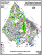
Open Space Map (3mb)
City of Shelton Open Space Marker
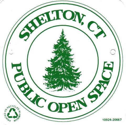
This marker is used to identify Public Open Space owned by the City of Shelton. It does not mark the exact location of the property line and may be as much as 100 feet away from the boundary, depending on site conditions. The Conservation and Pedestrian Easements markers have a similar look but different text.
Land Trust Marker
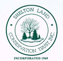
The Land Trust is a private, non-profit group that owns 364 acres of open space in Shelton, marked with these signs. People frequently confuse the Land Trust with the City of Shelton.
Wetlands Marker
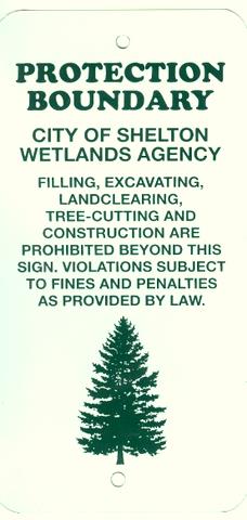
These rectangular wetlands marker may be found in some newer subdivisions, usually on 4x4 posts. They mark the location of areas regulated by the Shelton Inland Wetlands Commission. These are generally on private property and are not related to open space.
OS 7.02 (6.49 acres) and OS 7.03 (2.13 acres)
Canfield Drive, adjacent to Capewell Park
 This
open space is located along both sides of Canfield Drive and features an
unnamed stream. There are no official trails. The properties abutt Capewell
Park (OS 7.01).
This
open space is located along both sides of Canfield Drive and features an
unnamed stream. There are no official trails. The properties abutt Capewell
Park (OS 7.01).
A Landkeeper or neighborhood volunteer is needed to keep litter cleaned up along Canfield Drive.
Maps and Photos (click to enlarge)
 Open
Space Map
Open
Space Map
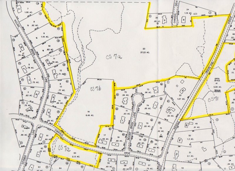 Tax Map (7b and 7c)
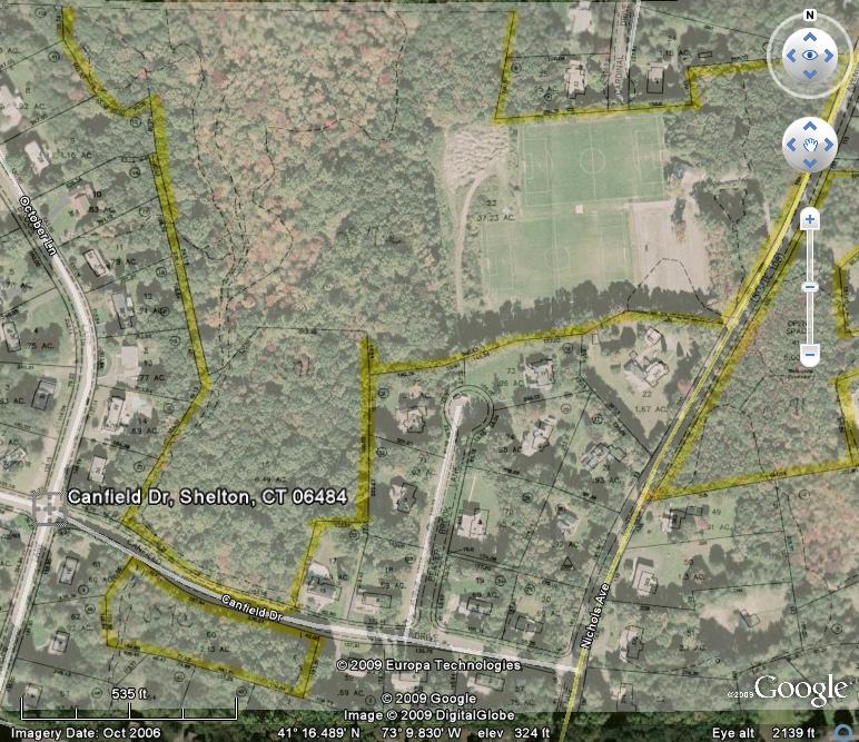 Map overlay (showing part of Capewell Park also)
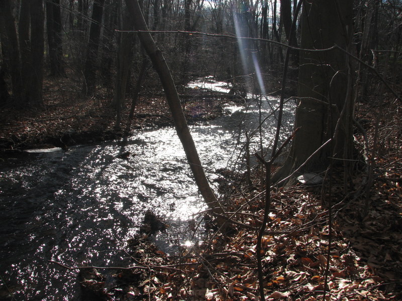
 An unnamed brook flows from a swamp at Capewell Park south towards
Canfield Drive.
An unnamed brook flows from a swamp at Capewell Park south towards
Canfield Drive.
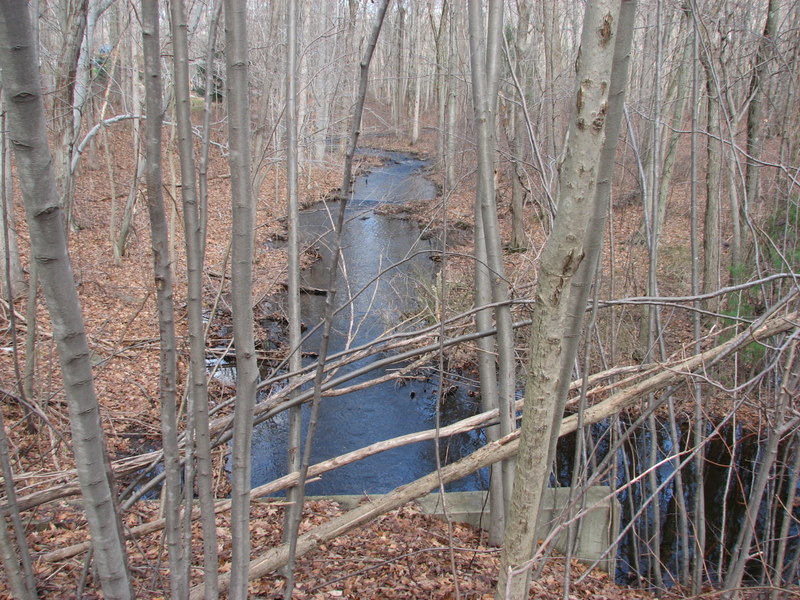
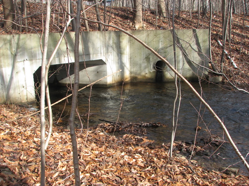 The brook flows through a box culvert under Canfield Drive.
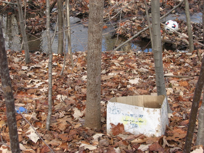 Litter along Canfield Drive and a feeder stream is chronic. A
volunteer Landkeeper is needed to keep the area clean.
Litter along Canfield Drive and a feeder stream is chronic. A
volunteer Landkeeper is needed to keep the area clean.
Deeds and Filed Maps
OS 7.02 and OS 7.03 were both acquired under subdivision regulations as part of the approval for Nichols Woods subdivision in 1986 by James Bargas. The deed for both was filed at Volume 695 Page 76 on October 10, 1986. The filed map is recorded at Vol. 36, Page 2267.