Conservation Commission
Shelton, Connecticut
 OPEN
SPACE MENU
OPEN
SPACE MENU
Open Space Links
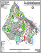
Open Space Map (3mb)
City of Shelton Open Space Marker
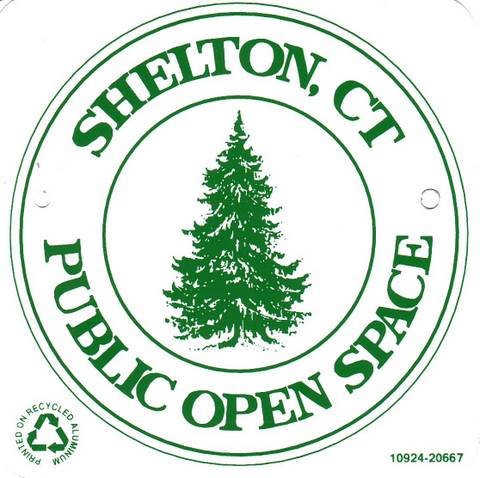
This marker is used to identify Public Open Space owned by the City of Shelton. It does not mark the exact location of the property line and may be as much as 100 feet away from the boundary, depending on site conditions. The Conservation and Pedestrian Easements markers have a similar look but different text.
Land Trust Marker
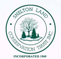
The Land Trust is a private, non-profit group that owns 364 acres of open space in Shelton, marked with these signs. People frequently confuse the Land Trust with the City of Shelton.
Wetlands Marker
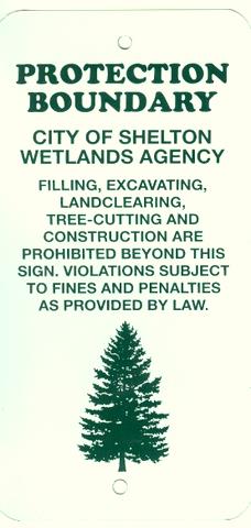
These rectangular wetlands marker may be found in some newer subdivisions, usually on 4x4 posts. They mark the location of areas regulated by the Shelton Inland Wetlands Commission. These are generally on private property and are not related to open space.
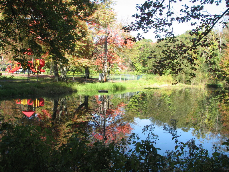
OS 2.01 and 2.02 Pine Rock Playground (2.53 ac.)
Algonkin Road, Mohawk Drive, and Long Hill Avenue
 Features:
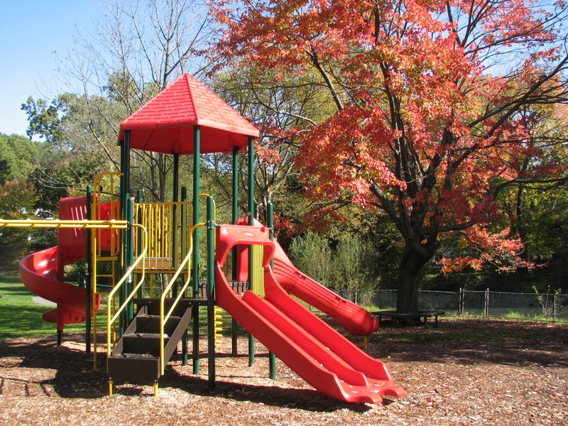
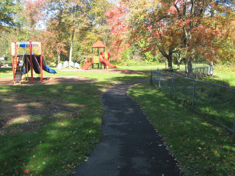
This small park offers a playground, picnic area, paved walkway, and a
pond for residents of the
congested Pine Rock Park neighborhood. A four-foot
chain linked fence prevents young children from running into the pond or
Long Hill Avenue. The grounds are maintained by the Shelton Parks and
Recreation Department.
Features:
This small park offers a playground, picnic area, paved walkway, and a
pond for residents of the
congested Pine Rock Park neighborhood. A four-foot
chain linked fence prevents young children from running into the pond or
Long Hill Avenue. The grounds are maintained by the Shelton Parks and
Recreation Department.
The paved path, in the shape of a horseshoe, is approximately 750 feet long. The roadway can be used to complete a loop of about 0.2 mile, or five laps per mile.
Access: Parking is on Algonkin Road.
Maps and Photos (click to enlarge)
| Open Space Map |
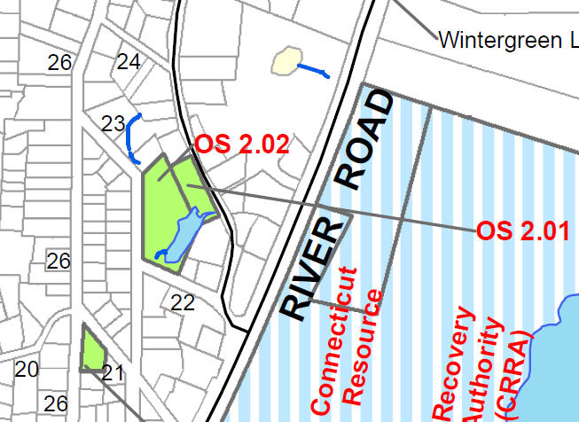 |
| Tax Accessor's Map Parcel 2.01 Map 12 Lot 8 |
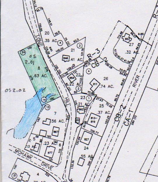 |
| Tax Accessor's Map Parcel 2.02 Map 12.C Lot 83 |
 |
| Aerial View |
 |
| Paved path and playground |
 |
| Pond |
 |
| Arrowhead at the pond's edge |
 |
Deed History
On August 29, 1963, a deed recorded at Vol. 193 Page 244 records the sale of a number of Pine Rock properties to the City of Shelton for "a valuable sum in Dollars." The deed references a map for Oronoque Manor Estates dated April 5, 1930, and filed at Vol. 2 Page 93, including Lots 14 through 24 in Block 2, which correspond in the aggregate to open space #2.01 (Map 12 Lot 8), and to "properties that are designated as Preserved, bordered by Algonkin Road," which corresponds to open space #2.02 (Map 12c Lot 83).
There are no known deed restrictions on the properties.